

Comparing different countries, continents, and cities’ sizes with intriguing overlaid maps
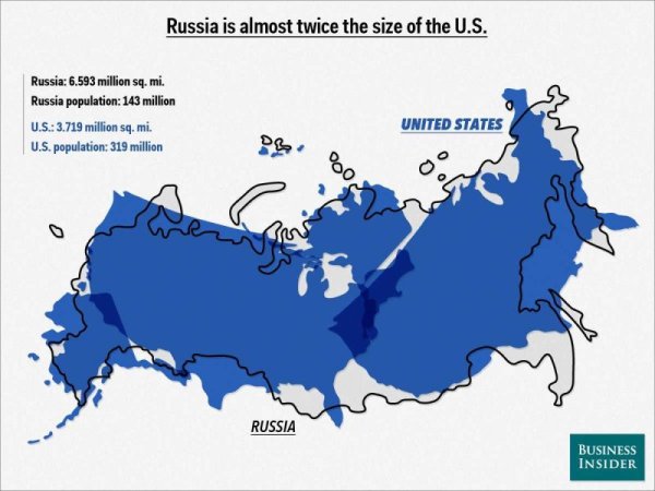
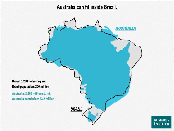
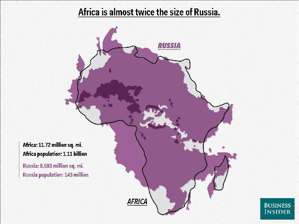
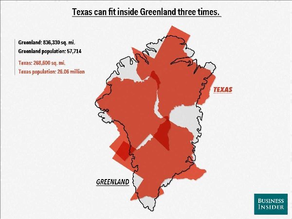
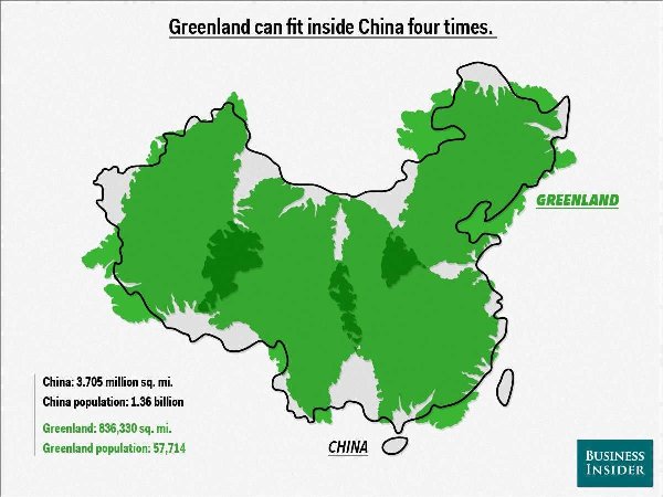
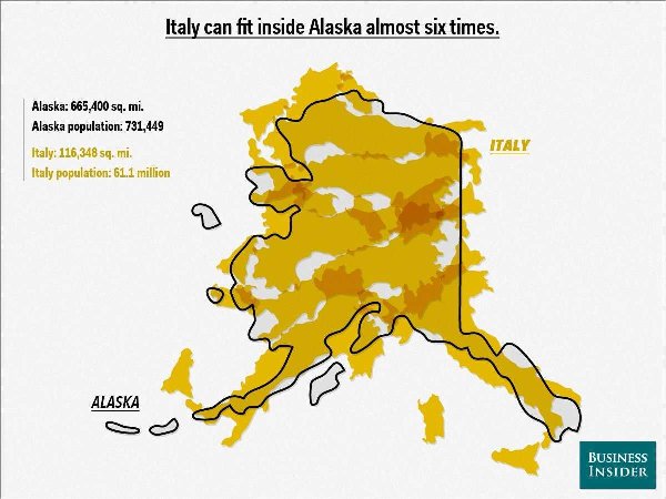
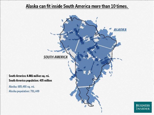
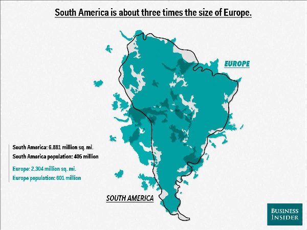
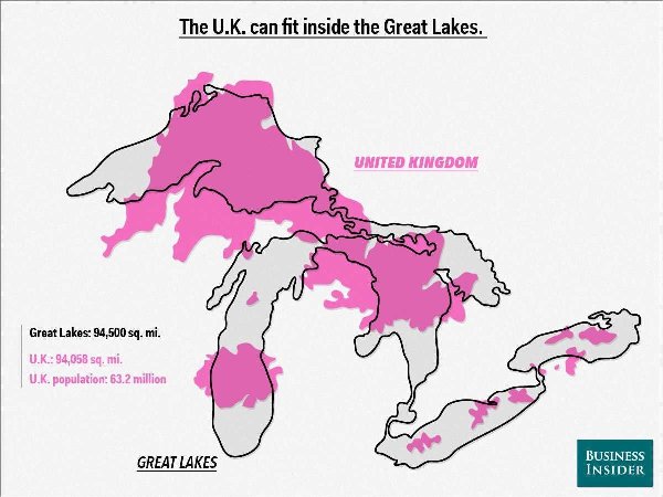
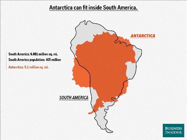
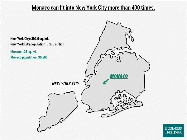
Business Insider has created 11 maps that reveal fascinating facts about the land areas of countries around the world. For example, did you know that Alaska can fit inside South America more than 10 times? Or that the second smallest country in the world Monaco can fit into New York City more than 400 times?
Since we don’t normally think about any of these places together, these maps help us get a better sense of each country’s mass, and how big or small they are in relation to each other.
Check out the maps below !
[ via ] Don’t forget to follow Feeldesain on Twitter + Facebook + Pinterest to get all the latest updates.